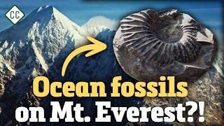
In 1924, geologist Noel Odell was climbing the side of Mount Everest when he dug up something that made absolutely no sense: fossils of ancient ocean-dwelling invertebrates — near the top of the tallest mountain on Earth. How are ocean fossils found on Mount Everest? The answer lies in one of geology's most dramatic stories: two continents colliding, an ancient ocean disappearing, and seafloor being scraped up and launched toward the sky over millions of years. Buckle up.
 00:32
Marine fossils discovered at high elevation on Mount Everest, showing ancient ocean invertebrates
Watch at 00:32 →
00:32
Marine fossils discovered at high elevation on Mount Everest, showing ancient ocean invertebrates
Watch at 00:32 →
Why Are Ocean Fossils Found on Mount Everest?
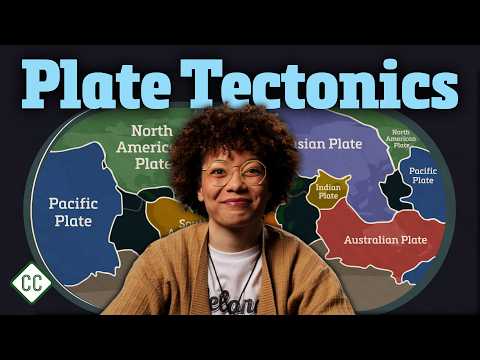
The short answer: the rocks that now form the summit of Everest used to be at the bottom of an ancient ocean called the Tethys Sea. When the Indian tectonic plate crashed into the Eurasian plate, the ocean floor in between got caught in the collision. Some of that seafloor — sediment, rock, and yes, fossils — was scraped off and piled up between the converging continents in a formation called an accretionary wedge. Over millions of years, the continued compression of India pushing into Eurasia shoved that accumulated material higher and higher, eventually forming the Himalayan mountain range. Those ancient sea creatures never went anywhere. The ground beneath them just rose dramatically around them.
How Were the Himalayan Mountains Formed?
The Himalayas are one of the most dramatic examples of orogeny — the geological process of mountain building — on the planet. Here's how it unfolded:
- The Indian continental plate began moving northward toward the Eurasian plate.
- Between them sat an oceanic plate beneath the prehistoric Tethys Ocean.
- That oceanic plate began subducting — sliding beneath the Eurasian continent — dragging India along with it.
- When the two continental plates finally collided, the enormous compressive force caused the land to crumple and buckle, pushing rock upward in massive waves.
- The scraped-up seafloor of the Tethys Ocean piled up into that accretionary wedge, which was then thrust skyward as the collision continued.
The result? The highest mountain range on Earth. And the process isn't finished. India is still pressing into Asia today, pushing parts of the Himalayan range upward by as much as a centimeter per year. Mount Everest is literally still growing.
04:15
Diagram of the Indian plate subducting beneath the Eurasian plate, forming the Himalayas and an accretionary wedge
Watch at 04:15 →
What Are the 3 Types of Tectonic Stress?
To really understand how mountains, valleys, and faults form, you need to understand the three types of stress that tectonic forces apply to rocks in Earth's lithosphere:
Compression
Compression squeezes rocks together. It's the dominant force behind mountain building. When two plates converge, the crust thickens rather than thins, and the land is pushed upward. This is exactly what built the Himalayas — and what once made the Appalachians just as tall as the Andes.
Tension
Tension pulls rocks apart. At divergent plate boundaries, the crust stretches and thins. This creates entirely different landforms — valleys, rifts, and eventually, new ocean basins. The East African Rift Valley is one of the most spectacular examples of tension reshaping a continent in real time.
02:10
Visual demonstration of the three types of geologic stress: compression, tension, and shear using a candy bar
Watch at 02:10 →
Shear Stress
Shear stress moves rocks in parallel but opposite directions — think of sliding two pieces of paper past each other. This lateral grinding creates some of the most seismically active zones on the planet, including the infamous San Andreas Fault in California.
Under enough stress, rocks deform in one of two ways: plastic deformation (slow bending under deep heat and pressure, like taffy), or brittle deformation (snapping near the surface, like a frozen candy bar). That brittle breaking? That's how faults are born.
What Are Normal, Reverse, and Strike-Slip Faults?
A fault is a deep fracture in Earth's crust caused by movement. Different types of stress produce different types of faults, and each one reshapes the landscape in distinct ways.
06:45
The East African Rift Valley shown on a map, stretching from Jordan to Mozambique
Watch at 06:45 →
Normal Faults
Created by tension, normal faults form when the rock above the fault line slides downward relative to the rock below. You typically find these at divergent boundaries — like the ones responsible for the Mid-Atlantic Ridge running along the floor of the Atlantic Ocean.
Reverse and Thrust Faults
Created by compression, reverse faults occur when the block on top is pushed up and over the block below. When that fault angle is shallow, geologists call it a thrust fault. The Himalayas sit on a giant example called a megathrust fault. These fault types are capable of generating the largest earthquakes ever recorded — including the 1960 Chile earthquake, the most powerful in history.
Strike-Slip Faults
Created by shear stress, strike-slip faults see two blocks of crust grinding horizontally past each other. When they sit along plate boundaries, they're called transform faults. The San Andreas Fault is the most famous example, cutting through California and generating frequent earthquakes. These faults can carve long valleys, create sharp cliffs, and even redirect rivers over time.
What Is an Accretionary Wedge?
An accretionary wedge forms during subduction, when one tectonic plate dives beneath another. As the subducting plate descends, it drags sediment, rock, and marine material with it — but not all of it makes it down. Some gets scraped off against the overriding plate and accumulates in a wedge-shaped pile at the boundary.
In the case of the Himalayas, the subducting Tethys oceanic plate left behind enormous amounts of ocean floor sediment — including fossils of marine invertebrates. As India continued to push northward, that wedge got compressed and uplifted, ultimately becoming part of the mountain range we see today. It's why you can find seashell fossils at 8,000 meters of elevation. Geology is wild.
What Is the East African Rift Valley?
On the opposite end of the tectonic spectrum from the Himalayas, the East African Rift Valley is one of the most striking examples of tension reshaping a continent. Stretching from Jordan all the way down to Mozambique, it's a region where two tectonic plates are slowly pulling apart — and the land in between is sinking.
In some areas, the valley floor has already dropped below sea level. The plates are still separating at a rate of up to 1.5 centimeters per year. Research by Nigerian-American geologist Dr. Folarin Kolawole and others suggests the fault systems could eventually extend into South Africa and toward the Atlantic Ocean. The long-term implication? The African continent could one day fracture into separate landmasses, with a new ocean filling the gap between them. In the meantime, increased seismic activity in the region is a real and growing concern.
Why Are the Appalachian Mountains Getting Smaller?
The Appalachian Mountains of the eastern United States were once potentially as towering as the modern Andes. But unlike the Himalayas, they're no longer being built up. The tectonic forces that once compressed and uplifted the eastern edge of North America have shifted — there's no convergent boundary there anymore.
Without compression to counteract it, erosion takes over. Wind, water, and ice have been wearing the Appalachians down for millions of years, and they'll continue to do so. It's a reminder that nothing in geology is permanent. Today's towering peak is tomorrow's rolling hill, given enough time and enough weather.
What Does All This Mean for Earth's Future?
Plate tectonics is an ongoing story, not a finished one. Mount Everest is still growing. The East African Rift is still widening. The Appalachians are still shrinking. Every year, the continents nudge a little further along their paths — colliding, separating, and reshaping the world's surface in ways that unfold over geological time but leave permanent marks we can read in rock.
The next time you're hiking through mountains or driving past a roadside cliff face, remember: you're looking at millions of years of compression, tension, shear, subduction, uplift, and erosion — all written in stone. And somewhere up on Everest, a few ancient sea creatures are still along for the ride.